Discover the Fascinating Geological History and Spectacular Beauty of the Ring of Fire Region
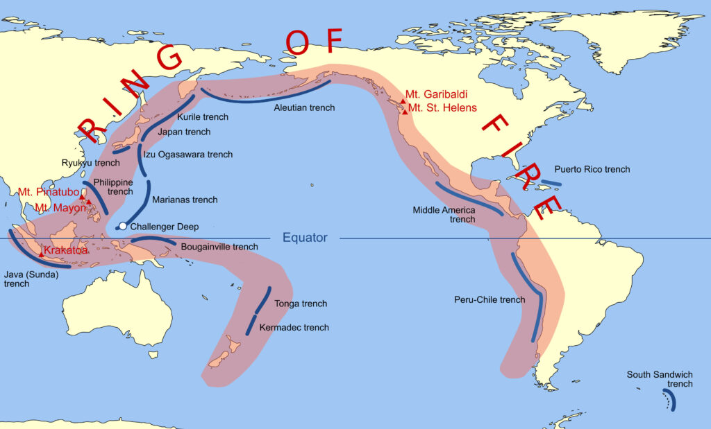
The Ring of Fire is a region in the Pacific Ocean known for its high level of volcanic and seismic activity. It encompasses a horseshoe-shaped series of oceanic trenches, volcanic arcs, and tectonic plates that run along the edges of the Pacific Ocean.
The islands and countries within the Ring of Fire, including Japan, Indonesia, the Philippines, Papua New Guinea, and New Zealand, are hotspots of geological activity. This area is home to some of the world’s most active and famous volcanoes, and the movement and collision of tectonic plates cause frequent earthquakes and other geological events.
In this region, the forces of nature are constantly at work, shaping the landscape and impacting the lives of the people who call it home.
Some of the islands and countries located in the Ring of Fire include:
- Japan
- Indonesia
- Philippines
- Papua New Guinea
- New Zealand
- Chile
- Peru
- United States (Alaska, Hawaii)
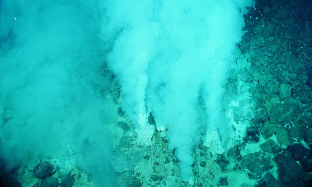
These areas are hot because they are located at the boundaries of tectonic plates, which are large sections of the Earth’s crust that move and interact with each other. The movement and collision of these plates cause earthquakes, volcanic eruptions, and the formation of mountain ranges.
The Ring of Fire is particularly active because it is located where several of these tectonic plates meet, creating a zone of intense geological activity. This area is also associated with many active volcanoes, including some of the world’s most famous, such as Mount Fuji in Japan, Mount Mayon in the Philippines, and Mount St. Helens in the United States.
Did you know?
The Ring of Fire is often described as horseshoe-shaped because it follows the edges of the Pacific Ocean in a broad arc rather than forming a perfect circle.
However, the term “Ring of Fire” has become a widely recognized and popular name for this region due to the intense volcanic and seismic activity that characterizes it.
This activity results from the tectonic plate boundaries that encircle the Pacific Ocean, creating a zone of high geological activity often called a “ring.” The name “Ring of Fire” has become synonymous with this area of intense geological activity, even though the shape is not perfectly circular.
A little history:
The Ring of Fire stretches back millions of years. The region was formed due to the movement and interaction of several tectonic plates that make up the Earth’s crust. These plates move and collide with each other, causing volcanic eruptions, earthquakes, and the formation of mountain ranges.
The Ring of Fire formed around 200 million years ago when a supercontinent called Pangaea began to break apart. This caused the tectonic plates to shift and move, eventually creating the Pacific Ocean and the various land masses that border it.
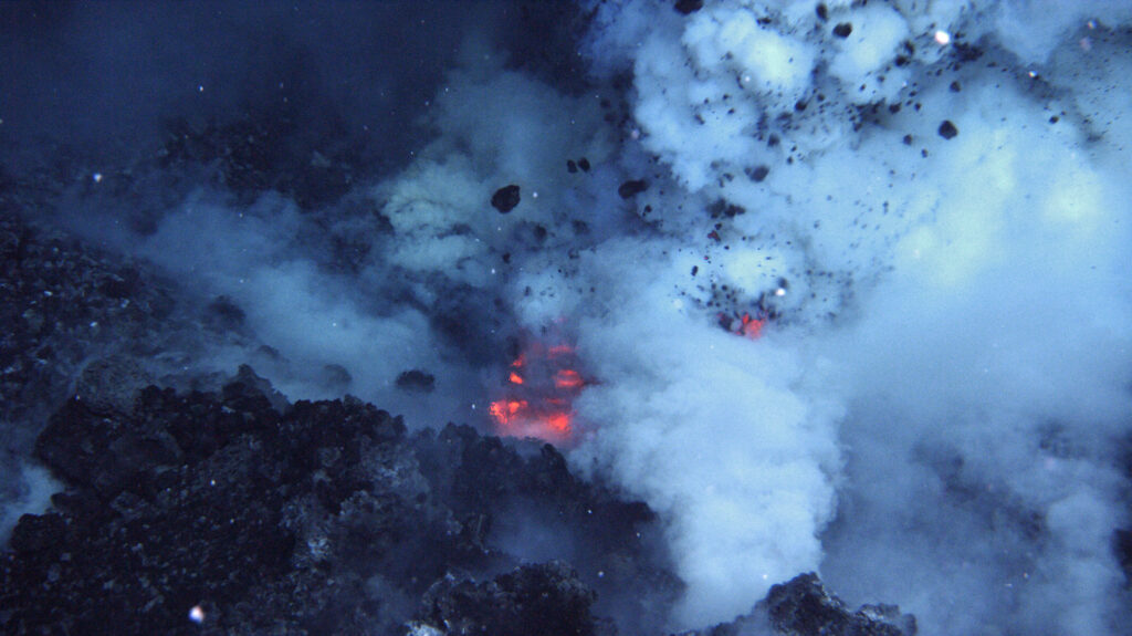
Over time, the interaction of these tectonic plates has created a zone of high geological activity known as the Ring of Fire. The area is characterized by volcanic eruptions, earthquakes, and other geological events that have shaped the landscape and impacted the lives of people in the region.
Throughout history, the Ring of Fire has been the site of some of the world’s most devastating natural disasters, including the eruption of Mount Vesuvius in Italy in 79 AD, which buried the city of Pompeii under volcanic ash, and the 2011 earthquake and tsunami in Japan, which killed thousands of people and caused widespread destruction.
Research continues to monitor hot spot areas.
Many people call the Ring of Fire home despite the risks associated with living in an area of such high geological activity. The region’s natural resources, such as geothermal energy and mineral deposits, have made it important for economic development. Many communities have adapted to living in this unique and dynamic environment.